Not just the road between the falls and Niagara-on-the-Lake
Most visitors meet the Niagara Parkway by accident, as the road their taxi or rental car takes between the falls and Niagara-on-the-Lake. That’s a fair way to first use it, but treating it purely as transit misses what it actually is: a 55-km riverside drive, built for exactly this kind of unhurried travelling, with several stops worth making on their own merits and one season — fall — when the road itself is the reason to come.
The Parkway runs the full length of the Niagara River on the Canadian side, from Fort Erie in the south, opposite Buffalo, to Niagara-on-the-Lake in the north, where the river empties into Lake Ontario. Most people join it somewhere near the falls, which sit close to the midpoint, and drive north toward wine country or south toward the quieter Fort Erie end. This guide covers the drive itself and the stops strung along it — it doesn’t re-cover Queen Victoria Park or Niagara Glen, both of which have their own detailed pages, or Journey Behind the Falls, which sits just off the Parkway near the falls themselves.
Where the Parkway runs
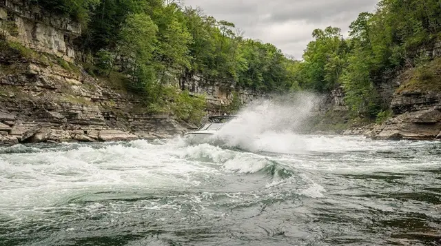
South of the falls, the road hugs the Niagara River past the Whirlpool and the gorge, with Niagara Glen reachable off to one side. North of the falls, the character changes: the gorge opens into a wider, calmer river valley, orchards and vineyards start to appear on the escarpment side of the road, and the drive becomes noticeably more rural. This northern stretch, roughly from the falls to Niagara-on-the-Lake, is the section most people mean when they talk about “driving the Parkway,” and it’s the one this page focuses on.
It’s a two-lane road for most of its length, with a lower speed limit than the parallel highway and frequent pull-offs. That’s deliberate — the Parkway was never built to move traffic quickly, and treating it as a shortcut misses the point. Give it more time than a map suggests.
The Niagara River Recreation Trail: the same route on two wheels
Running alongside the road for almost its entire length is the Niagara River Recreation Trail, about 56 km of paved, largely flat cycling and walking path that follows the river from Fort Erie to Niagara-on-the-Lake. It’s one of the easier long rides in the region — no serious climbs, the river as a constant landmark, and enough small towns and stops along the way to break up the distance.
Cyclists can ride the whole thing in a long day or pick a shorter section; the stretch between the falls and Niagara-on-the-Lake is the most scenic and the one most day-trippers choose. Renting a bike for this stretch is also the practical answer to the region’s one hard rule: you don’t drive after a winery visit, and a bike route that passes several tasting rooms solves that problem on its own.
Along the way: the Floral Clock, the Floral Showhouse and Dufferin Islands
A handful of stops break up the drive north of the falls, all free or low-cost, and none requiring more than 20 to 30 minutes.
The floral clock, a working clock face planted entirely in bedding flowers and changed several times a year, sits beside the Parkway and is one of the more photographed small stops in the region — more a curiosity than a destination, but an easy pull-off. Nearby, the Floral Showhouse is a greenhouse complex with tropical plants, koi ponds and, at times, free-flying birds — a reasonable indoor option if the weather turns, though it’s smaller and quieter than the region’s dedicated conservatories.
Dufferin Islands, a cluster of small artificial islands and footbridges around calm ponds just south of the falls, is the easiest picnic stop on the whole route — shaded, quiet, with parking right off the Parkway. It’s also one of the settings for the Winter Festival of Lights display, so it’s worth a look both by day in summer and after dark in winter.
None of these three are why someone plans a trip to Niagara, and none needs more than half an hour. Their value is exactly that: they turn a drive into a series of short, free stops instead of a straight run from one paid attraction to the next.
Queenston Heights: where the escarpment breaks open
Toward the northern end of the Parkway, the land rises sharply where the Niagara Escarpment meets the river, and Queenston Heights sits at the top of that rise — a park with wide lawns, mature trees and a genuinely good view back down the gorge toward Lake Ontario. It’s also a War of 1812 battlefield: the Battle of Queenston Heights was fought here on 13 October 1812, and the 56-metre monument to Major-General Isaac Brock, who died in the battle, stands on the site. The village of Queenston itself, just below, includes Laura Secord’s house and connects to Fort George, the restored fort a short drive north in Niagara-on-the-Lake.
Queenston Heights works as a stretch-the-legs stop on the way to Niagara-on-the-Lake, and as a half-day destination if the history interests you — the battlefield, the monument and the view are enough to justify stopping specifically rather than just passing through.
Fall on the Parkway: the best season nobody plans for
Summer gets the crowds and winter gets the ice, but fall — late September into October — is when the Parkway earns being called a destination rather than a road. The escarpment above Queenston Heights turns, the vineyards around Niagara-on-the-Lake are mid-harvest, and the crowds thin noticeably compared with July and August. Everything along the route stays open through the end of October, which isn’t true in winter, and the weather is usually more reliable for a scenic drive than spring.
If a trip can move to September or October, the Parkway is one of the clearest reasons to do it — not because any single stop changes, but because the drive between them does.
a full day that pairs the drive north along the river with wine-country stops in Niagara-on-the-Lake is one way to let someone else handle the driving on a fall trip, particularly if wine tasting is part of the plan.
Winter Festival of Lights: the Parkway after dark, November to January
From November through January, the Parkway becomes the route for the Winter Festival of Lights, a free, drivable or walkable display of illuminated installations strung along the road and concentrated around Dufferin Islands. It’s a legitimately different way to experience the same stretch of road most people only drive by daylight, and it costs nothing beyond parking. This is the clearest case against treating the Parkway as pure transit: in winter, when several of the region’s paid attractions close for the season, the road itself — lit up after dark — is one of the few things still fully open and worth the drive on its own.
an evening out that combines the illuminated falls with a look behind the Horseshoe pairs naturally with a Parkway drive on the same trip, since both depend on the same after-dark illumination season.
Driving it: how long it actually takes
| Stretch | Distance | Typical drive time |
|---|---|---|
| Falls to Queenston Heights | About 15 km | 15–20 minutes |
| Falls to Niagara-on-the-Lake | About 26 km | 25–30 minutes |
| Fort Erie to Niagara-on-the-Lake (full Parkway) | About 55 km | 55–70 minutes non-stop |
| Cycling the full trail (Niagara River Recreation Trail) | About 56 km | 4–6 hours at a relaxed pace |
Those times assume no stops. Add 20–30 minutes for each of the Floral Clock, Dufferin Islands or a Queenston Heights walk, and expect the road to be busier on summer weekends and around sunset in fall, when photographers pull off for the light on the escarpment.
What’s already covered elsewhere
A few well-known stops sit directly on or near the Parkway but are detailed on their own pages rather than here: Queen Victoria Park, the formal gardens right at the falls; Niagara Glen, the one real hiking trail on the Canadian side, reached via a short spur off the Parkway; and Journey Behind the Falls, which sits at Table Rock near the Parkway’s midpoint. If any of those is the actual reason for the trip, their own pages go into the detail this one deliberately skips.
Where the Parkway ends: Niagara-on-the-Lake and the wine route
The Parkway’s northern end delivers you into Niagara-on-the-Lake, where the road’s character — orchards, vineyards, quiet river views — turns into the region’s most concentrated stretch of wineries, most of them a short detour off the route in its final few kilometres. This is the natural handoff point: the Parkway is the approach, Niagara-on-the-Lake and the surrounding wine region are the destination. Given that nobody should drive after a tasting, a chauffeured option solves the obvious problem.
a private evening of tastings and dinner in Niagara-on-the-Lake with someone else doing the driving is the straightforward way to close out a Parkway day without worrying about the return leg.
For a shorter, falls-focused day that still touches the river, a walking and boat combination that gets you onto the water near the falls or the boat-and-behind-the-falls combination on the Canadian side both work as a half-day anchor before or after a Parkway drive, rather than a full day given over to wine country.
Practical notes
Fuel and food options thin out along the rural, northern stretch of the Parkway — fill up and eat before leaving the falls or in Niagara-on-the-Lake itself, not in between. Parking is generally easy and free at the smaller stops (the Floral Clock, Dufferin Islands); Queenston Heights has its own lot. If cycling rather than driving, allow considerably more time than a car and check that bike rental includes a repair kit — services thin out on the northern half of the trail too.
The road is open year-round, but winter driving conditions on an unlit, two-lane riverside route deserve normal winter caution, particularly after dark during the Winter Festival of Lights, when both traffic and pedestrians increase along the same stretch of road.
Niagara Parkway: frequently asked questions
How long is the Niagara Parkway, and where does it start and end?
About 55 km, running along the Niagara River from Fort Erie in the south to Niagara-on-the-Lake in the north, where the river meets Lake Ontario. Most visitors join it somewhere around the falls, roughly the midpoint.
How long does it take to drive the whole Parkway?
The drive itself is under an hour without stopping. Budget half a day if you want to get out of the car at the Floral Clock, Dufferin Islands or Queenston Heights, and a full day if Niagara-on-the-Lake or a winery is the destination.
Can you cycle the Niagara Parkway?
Yes. The Niagara River Recreation Trail runs about 56 km alongside the river, largely following the Parkway, and is mostly flat and paved. It’s one of the more approachable long rides in the region.
Is the Niagara Parkway free to drive?
Yes, there’s no toll and no admission to drive it. You pay only for parking at specific stops and for anything you visit along the way, such as the Floral Showhouse or a winery tasting.
What’s the best time of year to drive the Niagara Parkway?
September and October for escarpment colour along the route, and November through January if you want to see the Winter Festival of Lights displays after dark. The drive itself is open and worthwhile year-round.
Is the Niagara Parkway just a way to get to Niagara-on-the-Lake, or worth doing for itself?
Both. It’s the natural connector between the falls and Niagara-on-the-Lake, but the Floral Clock, Dufferin Islands and Queenston Heights are worth stopping for on their own, and fall colour or the winter lights are reasons to drive it even without a fixed destination.
Where’s the best stop for a picnic or a break along the Parkway?
Dufferin Islands, a cluster of small islands and footbridges around quiet ponds just south of the falls, is the easiest and most sheltered stop for a break, with parking and shade.
Does the Parkway connect to the wine route?
Yes. The Parkway feeds directly into Niagara-on-the-Lake, the heart of the Niagara-on-the-Lake wine sub-appellation, and several wineries sit just off the road in its northern stretch.