Queenston Heights and the Battle of October 13, 1812
What happened at Queenston Heights, and can you visit the site today?
On October 13, 1812, American forces crossed the Niagara River and took the heights above Queenston; a British counterattack later that day, led after General Isaac Brock's death, drove them back. The battlefield is now a free public park with Brock's Monument, walking trails, and river views, about a 25-minute drive north of Niagara Falls on the Niagara Parkway.
A battlefield at the north end of the Parkway
Queenston Heights is the northern bookend of the Niagara Parkway, a wooded escarpment park about 13 kilometres (8 miles) north of the falls and roughly 8 kilometres past Niagara-on-the-Lake if you’re driving up from the falls themselves. It’s easy to lump it together with the village’s wine country and colonial-era charm, but the two places sit apart on the map and tell different stories.
This page covers what happened on the heights on October 13, 1812, what remains of the battlefield today, and the monument and small museum that sit on and near it. It doesn’t retrace Niagara-on-the-Lake itself, and it doesn’t cover Fort George or Old Fort Niagara in any detail — those forts, on opposite banks of the Niagara River, get their own page, since they were built and garrisoned to do a different job than the ridge that rises above the village of Queenston.
The heights themselves are the escarpment’s edge, rising abruptly above the river and the village below. From the monument grounds you can see across to Lewiston, New York, on the American side, and down the gorge toward the whirlpool. That elevated position is exactly why both armies wanted it in October 1812: whoever held the heights held the high ground over the river crossing.
The morning of October 13, 1812
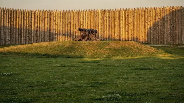
Just before dawn, American regulars and militia began crossing the Niagara River from Lewiston in small boats, aiming to land below the heights and seize the high ground before the British garrison at Queenston could react in force. The crossing was chaotic — strong current, limited boats, and heavy fire from British and Canadian defenders on the Canadian bank cost the Americans dearly in the first hour. Enough troops got across regardless, and a detachment found an unguarded fisherman’s path up the escarpment face, climbed it, and took the British artillery battery on top of the heights from behind.
Major-General Isaac Brock, commander of British forces in Upper Canada, was in nearby Fort George when the attack began and rode to Queenston at speed. Arriving to find the battery lost and the heights in American hands, he organized what troops he had on hand — a mix of regulars from the 49th Regiment of Foot and local militia — into an immediate counterattack up the slope to retake the guns.
Brock’s death, and the battle that continued without him
This is the point where the popular version of the story gets simplified into something the battle itself doesn’t support: Brock did not win Queenston Heights. He led that first counterattack on foot, was shot through the chest at close range, and died within minutes, roughly where a smaller monument now stands partway up the hill from the main column. His death, not long after the battle opened, left the British and Canadian forces without their senior commander for most of the day that followed.
The fighting did not end there, and the eventual British victory came from what happened next, not from anything Brock did before he fell. Major-General Roger Hale Sheaffe took over command and spent the following hours moving reinforcements — regulars, militia, and a substantial force of Six Nations and other Haudenosaunee warriors led by the Mohawk war chief John Norton — into position for a coordinated assault rather than another piecemeal rush up the slope. Norton’s warriors, who had been skirmishing with the American flank through the morning, played a decisive role in unsettling the American position on the heights before Sheaffe’s main attack went in during the afternoon.
When the combined British, Canadian, and Indigenous force advanced in the afternoon, the Americans on the heights — many of them exhausted, low on ammunition, and reduced in number because New York militia on the far bank refused to cross the river to reinforce them, citing a legal objection to being ordered outside U.S. territory — broke and were driven back toward the escarpment edge.
Some surrendered on the heights; others tried to escape down the cliff face toward the river and were killed, drowned, or captured trying to cross back. American losses, killed, wounded, and captured combined, ran into the hundreds, including the surrender of the senior American commander on the field, Brigadier-General William Wadsworth. British and Canadian losses were far lighter, but the day’s most consequential casualty, in terms of how the battle is remembered, was Brock himself.
The result was a clear tactical victory for the British and their Indigenous allies, and it stopped the first serious American attempt to establish a foothold in Upper Canada. But it’s worth being precise about what a visitor is actually standing on top of: a battlefield where the general commemorated by the monument was killed leading an attack that failed, and where the battle was won several hours later, by other commanders, under a different plan.
Brock’s Monument today
The column that dominates the park is not the original marker. An earlier monument on the site, completed in 1824, was badly damaged by a bomb in 1840, in what’s generally attributed to an act of political vandalism tied to unrelated unrest of the period. The present column, 56 metres tall, was built in the 1850s to replace it, with Brock’s remains reinterred beneath it.
A narrow spiral staircase of 235 steps climbs the inside of the column to an observation platform near the top, when it’s open — the stair closes periodically for maintenance, and there’s no posted year-round guarantee it will be accessible on any given visit, so treat the climb as a bonus rather than the plan. The view from the base of the monument, across the park lawns to the escarpment edge and down to the river and Lewiston beyond, doesn’t require the climb and is worth the walk regardless.
The grounds around the monument are landscaped parkland — mature trees, open lawn, picnic tables, and a network of paved and gravel paths that follow the edge of the escarpment. A smaller monument partway down the slope marks approximately where Brock fell, and interpretive panels around the site lay out the sequence of the battle in more detail than fits here. The park is unticketed and open to the public year-round; the interior of the monument, when accessible, typically follows a shorter seasonal schedule than the grounds.
Laura Secord’s house, in the village below
Down the hill from the park, in the village of Queenston itself, stands the small house where Laura Secord lived at the time of the war. Secord is remembered for a 32-kilometre walk she made in June 1813 — after the fighting at Queenston Heights, in a later phase of the war — to warn British forces of an impending American attack she’d overheard discussed while quartering American officers in her home. The warning contributed to a British and Indigenous victory at the Battle of Beaver Dams weeks later.
The house operates as a small heritage museum with its own hours, separate from the Queenston Heights park above it, and it’s a five-to-ten-minute walk or a two-minute drive downhill from the monument grounds. It’s a modest stop — a handful of period rooms, not a large site — but it rounds out the Queenston story with a figure whose contribution came from the village rather than the battlefield, and it’s the kind of add-on worth folding into the same visit rather than treating as a separate trip.
What the park looks like today
Queenston Heights functions as a working public park as much as a historic site. Locals use it for picnics, weddings, and short walks, and the battlefield history sits alongside — rather than instead of — that everyday use. A network of trails follows the escarpment edge north and south from the monument, connecting into the broader Bruce Trail system that runs along the Niagara Escarpment; casual visitors mostly stick to the paved loop nearest the monument, while hikers looking for a longer stretch can follow the escarpment trail further in either direction.
The escarpment-edge sections of trail have real drops and are not fenced along their full length, so it’s worth keeping a closer eye on kids here than at, say, Queen Victoria Park down by the falls. Views from the trail take in the river, the gorge, and the American shoreline; on a clear day you can see well past Lewiston into the New York countryside beyond.
Parking is available in a lot near the monument, with a fee charged during the main summer season and free access outside of it; the lot is not large, and it can fill on weekends when the park hosts events or during peak fall colour, when the escarpment above Queenston is one of the better stretches of foliage in the region.
How Queenston Heights fits into the wider War of 1812
The Battle of Queenston Heights was the largest single engagement fought in the Niagara theatre in the war’s first year, and it set a pattern that held for much of the rest of the conflict along this stretch of border: American attempts to establish a lasting foothold on the Canadian side of the river were repeatedly turned back, often with heavy losses, while the two sides’ forts — Fort George on the Canadian bank and Old Fort Niagara on the American — anchored garrisons that changed hands more than once as the war ground on into 1813 and 1814.
Those forts, and the sieges and occupations they went through, are a longer and separate story from the single day covered here, and the page dedicated to them picks it up from where this one leaves off.
Brock’s death at Queenston had consequences beyond the battlefield itself. He had been the dominant military figure in the defence of Upper Canada up to that point, and losing him this early in the war removed a commander whose earlier successes, including the capture of Fort Detroit two months prior, had done a great deal to steady a colony that was badly outnumbered by its neighbour. The scale of the monument built in his memory, and its position on the very ground where he fell, reflects how the battle was remembered in the decades after — as much a memorial to Brock personally as an account of how the day actually played out.
For a fuller sense of how this corner of the Niagara Peninsula carried the war forward, a visit to Queenston Heights pairs naturally with a stop in Niagara-on-the-Lake, whose own historic core and Fort George sit only a short drive downriver, and with the village of St. Davids nearby, which was burned by American forces later in the war.
Getting there and planning the visit
Queenston Heights sits at the top end of the Niagara Parkway, a scenic drive that hugs the river the whole way north from the falls, making the approach itself part of the visit rather than a chore to get through. Most visitors combine the stop with a longer day along the Parkway — the drive alone from central Niagara Falls, Ontario takes about 20 to 25 minutes without traffic, longer on a busy summer weekend.
There’s no public transit that runs directly to the park; it’s a driving or cycling destination. Cyclists can reach it via the Niagara River Recreation Trail, which runs the length of the Parkway and passes right by the park entrance — a natural stop on a longer ride up from the falls or down from Niagara-on-the-Lake.
For visitors without a car, a guided walking tour based in Niagara-on-the-Lake sometimes extends to cover Queenston and the monument as part of a longer itinerary, and a private day tour out of Toronto can usually be arranged to include the stop if you ask ahead — worth confirming with the operator before booking, since not every Toronto-to-falls itinerary makes the detour by default.
If a driver and a bit of local storytelling appeal to you more than a self-guided walk, a guided walking tour through Niagara-on-the-Lake and the surrounding historic sites often works Queenston into its route, and a private custom tour from Toronto can be built around the war history specifically rather than the wine country, if that’s the day you’re after.
Since the heights sit so close to the Niagara-on-the-Lake wine district, plenty of visitors fold the two into one day — a wine tour with lunch in the Niagara Peninsula or an afternoon wine and whiskey tour around Niagara-on-the-Lake pairs naturally with a morning spent on the battlefield, especially in fall, when the escarpment colour and the harvest season line up.
There’s no admission fee for the park or the monument grounds, and no advance booking required for a self-guided visit — just show up, park, and walk. The one thing worth checking ahead, if the monument’s interior is a priority, is whether the stair to the observation platform is open that week; Niagara Parks doesn’t guarantee it year-round, and there’s no reliable public schedule beyond what’s posted at the site itself.
History and heritage tours on GetYourGuide
Verified deep-linked GetYourGuide tours. Book through these links and we earn a small commission at no cost to you.
GetYourGuide does not provide a product photo for this activity — the image shows the meeting point, photographed by us.