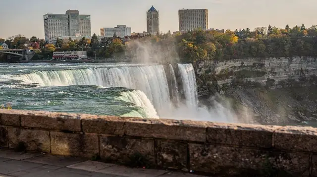
The Niagara Parkway by bike
How long is the bike ride from Niagara Falls to Niagara-on-the-Lake?
The Niagara River Recreation Trail follows the Niagara Parkway for about 56 km end to end, and the direct stretch from the falls area to Niagara-on-the-Lake is roughly 26 km one way. Most riders in reasonable shape cover that in two to three hours each way on mostly flat, paved terrain, though a few short, sharp climbs near Queenston Heights and some stretches that share the road with Parkway traffic slow the average pace.
Why the Parkway is the ride worth planning around
Of everything you can do along the Niagara River, the Niagara Parkway on a bike is the one activity that actually shows you the whole corridor instead of one attraction at a time. The Niagara River Recreation Trail runs beside the Parkway for about 56 km, from the river’s mouth near Fort Erie all the way to Niagara-on-the-Lake, tracing the same water that feeds the falls before it settles into Lake Ontario.
Almost nobody rides the entire 56 km in a single outing. What most visitors ride — and what this page is about — is the stretch north from the falls area to Niagara-on-the-Lake, a direct distance of roughly 26 km one way, passing Queenston, the floral clock, and Dufferin Islands along the way.
This is not a technical ride. There’s no elevation profile to worry about in the way a mountain trail would demand, no gravel to manage, and no navigation puzzle — you’re following one river, north or south, for the entire distance. What makes it worth a dedicated write-up instead of a line in a general itinerary is that the details that decide whether you enjoy it — how long it actually takes, where the pavement stops being a separated trail and becomes a road shoulder, where the only real hill sits — are exactly the details that get glossed over in most trip planning.
This page covers the route itself. For the village at the far end, see the dedicated Niagara-on-the-Lake day trip guide; for winery specifics, see the wine route guide and the cycling-focused wine route piece — neither is repeated here.
The route, stage by stage
Riding north from the falls, the trail generally breaks into four recognizable stretches.
Falls area to Niagara Glen (roughly 0–10 km). Most riders join the trail near Queen Victoria Park or Table Rock, where the Parkway runs close to the Horseshoe Falls before opening into calmer parkland. This section is flat, well paved, and mostly separated from car traffic, with the river gorge below you on the right as you head north. It passes Niagara Glen, where a short detour on foot down the metal staircase into the gorge is worth ten minutes off the bike if you haven’t done it already — though that’s a stop for another page, not something to fold into a riding day if you’re watching the clock.
Niagara Glen to Queenston (roughly 10–17 km). The trail continues to hug the river as the gorge widens out and the Whirlpool comes into view below. This is the most scenic stretch of the whole ride, and the flattest — you can hold a steady pace here without much thinking. It’s also where you start to notice the trail alternates between a dedicated paved path and a marked shoulder along the Parkway itself; drivers on the Parkway are used to cyclists, but this is not a car-free trail once you’re past the falls area.
Queenston to the floral clock and Dufferin Islands area (roughly 17–20 km). This is the one stretch to plan around. Queenston sits at the base of the escarpment, and the climb up toward Queenston Heights is short — well under a kilometre of actual grade — but it’s a real hill, not a gentle rise, and it’s the steepest thing on the entire route.
Riders on a standard bike will feel it in their legs; an e-bike erases it almost entirely. Past the climb, the route levels out again through open farmland and past the horticultural displays that lead toward Niagara-on-the-Lake, including the floral clock and the gardens around Dufferin Islands, both worth a slow-down rather than a blur.
Into Niagara-on-the-Lake (roughly 20–26 km). The final approach flattens out completely as the Parkway straightens toward the town. Traffic picks up somewhat closer to town on summer weekends, so this is the stretch where riding single file and staying alert matters most, even though the surface itself is easy. Once you’re in the village, this guide stops — Niagara-on-the-Lake has its own layout, its own pace, and its own page.
What “flat” actually means — and the one honest caveat
It’s fair to call this ride flat in the sense that matters for planning: there’s no sustained climbing, and a rider of average fitness won’t find the terrain itself the limiting factor. But two things get oversimplified in most descriptions of this trail, and both are worth stating plainly before you commit a day to it.
First, the elevation. The route isn’t perfectly level — besides the Queenston Heights climb, there are smaller rises and dips as the trail moves in and out of the Niagara Glen area and around a few points where the Parkway itself undulates slightly above the river. None of these individually amount to much, but on a hot day with a headwind coming off the river, they add up more than the word “flat” suggests.
Second, and more important: this is not a continuous, fully separated bike path for its entire length. Sections through the falls area and along the calmer stretches north of Queenston do run on dedicated, car-free paved trail. But other sections — noticeably around Queenston itself and in patches closer to Niagara-on-the-Lake — put you on the Parkway’s paved shoulder, riding alongside cars, tour buses, and the occasional cyclist coming the other way with less room to spare than you’d like.
Anyone describing this as a purpose-built, traffic-free cycling corridor from end to end is not describing it accurately. It’s a genuinely good ride, but it’s a shared-use corridor for real portions of it, and riding single file, using lights if you’re out near dusk, and staying predictable around the road-shared stretches isn’t optional caution — it’s necessary.
How long to budget
Timing depends more on how many stops you make than on fitness, since the terrain itself is forgiving. These are realistic ranges, not best-case numbers.
| Segment | Distance | Riding time (steady pace) | Riding time (with stops) |
|---|---|---|---|
| Falls area to Niagara Glen | ~10 km | 25–35 min | 45–60 min |
| Niagara Glen to Queenston | ~7 km | 20–25 min | 30–40 min |
| Queenston to floral clock / Dufferin Islands | ~3 km | 10–15 min (includes the climb) | 20–30 min |
| Floral clock area to Niagara-on-the-Lake | ~6 km | 15–20 min | 25–35 min |
| Full one-way total | ~26 km | 70–95 min | 2–2.5 hrs |
A round trip covering the falls-to-Niagara-on-the-Lake stretch both ways, with a lunch or tasting stop in the middle, is realistically a full day out — closer to five or six hours including stops than the two-hour riding time alone suggests. A half-day plan usually means riding one direction and returning by shuttle, taxi, or a tour that includes a drop-off, rather than doubling the distance on the bike.
Renting a bike or joining a guided ride
Self-guided is entirely workable on this route since there’s no navigation to speak of — you’re following the river. Bike rental outlets operate near the falls and in Niagara-on-the-Lake, and returning a rental at the far end from where you picked it up (rather than riding the full 52 km round trip) is common practice on this corridor.
For anyone who’d rather not manage logistics — bike condition, the Queenston Heights climb, or riding solo on the road-shared sections — a guided or assisted option removes most of the uncertainty. An e-bike tour along the falls and river corridor takes the climbing out of the equation entirely, which matters more than it sounds like it should once you’ve felt that one hill on a standard bike in July humidity.
For a more focused look at the gorge and island scenery near the falls before you commit to the longer ride north, a private e-bike tour through the islands and gorge covers that ground with a guide who knows exactly where the trail narrows or shares the road.
And if the appeal is really “get from the falls to Niagara-on-the-Lake without pedalling the whole way,” a guided tour between the falls and Niagara-on-the-Lake covers the same corridor by vehicle, which is worth knowing about even on a page about cycling it — some visitors decide partway through planning that they’d rather see the route than ride it.
Wine stops without a car — and the mistake to avoid
The trail’s proximity to the Niagara wine region is a real draw, and it’s tempting to treat a ride to Niagara-on-the-Lake as a built-in excuse to taste along the way. It can work, but the order matters. Drinking and then getting back on a bike for the return leg — on a route that includes road-shared sections and real traffic — is a worse decision than driving after drinking would obviously be recognized as, even though it doesn’t carry the same legal weight.
If tasting is the goal, the safer sequence is to ride out in the morning, taste at lunch, and arrange a return by shuttle, taxi, or tour rather than by bike; or better, let someone else do the driving in the first place with a Niagara-on-the-Lake wine tour that includes lunch, and save the bike ride itself for a separate, unencumbered day. For winery specifics and which appellations sit closest to the route, the wine route guide and the Niagara-on-the-Lake and wine country day trip itinerary go into that detail properly.
Practical notes before you set out
Water and washrooms exist along the way but aren’t frequent — carry more water than feels necessary, especially in summer humidity, since shade is inconsistent along the open stretches near the floral clock. Parking near the falls end fills early on weekends; see the parking guide for the Canadian side if you’re driving in to start the ride rather than starting from a hotel already in the area. Weather can turn faster than the forecast suggests this close to the river and the escarpment — a clear morning doesn’t guarantee a clear afternoon, and there’s limited shelter along most of the route if a storm rolls through.
Wildlife and gardens along the corridor — including the plantings around Dufferin Islands and the areas near Niagara Glen — are covered in more depth in the wildlife and gardens guide, and the history at the Queenston end, including the 1812 battlefield at Queenston Heights, has its own page in the Queenston Heights and the War of 1812 guide if the climb up the escarpment leaves you wanting the context for why there’s a monument at the top.
FAQ: cycling the Niagara Parkway
How long is the Niagara Parkway bike trail?
The Niagara River Recreation Trail, which runs beside the Niagara Parkway, is about 56 km from the Niagara River’s mouth at Fort Erie to Niagara-on-the-Lake. Most visitors ride only a section of it — commonly the roughly 26 km stretch between the falls area and Niagara-on-the-Lake.
Is the whole route a separated bike path?
No. Long sections run on a dedicated paved trail set apart from the road, but several stretches — particularly around Queenston and closer to Niagara-on-the-Lake — put cyclists on the Parkway’s paved shoulder alongside car traffic. Treat it as a mixed route, not a fully car-free one.
How long does it take to cycle from Niagara Falls to Niagara-on-the-Lake?
Budget two to three hours one way at a relaxed pace with a couple of photo stops, or closer to 90 minutes if you ride steadily without stopping. An e-bike cuts that meaningfully, especially on the short climb near Queenston Heights.
Is the route flat?
Mostly, yes — the trail follows the river and stays close to water level for most of its length. The exception is the climb up to Queenston Heights, a short but genuinely steep rise, plus a handful of smaller undulations elsewhere. A standard bike handles the whole route; an e-bike simply makes the climb easier.
Can I rent a bike along the way?
Yes, rental outlets operate on both the falls end and in Niagara-on-the-Lake, and several tour operators run guided or self-guided e-bike routes that cover some or all of the same corridor, with drop-off options so you don’t have to ride back the way you came.
Can I combine the ride with wine tasting?
Many riders do, since the trail passes close to the Niagara-on-the-Lake wineries, but pace yourself: cycling after drinking carries real risk on a shared road with car traffic, uneven shoulders, and no separation in places. A tour with a driver, or tasting on the way out and riding back sober, is the safer order.
Where does the trail actually start and end near the falls?
Most riders pick it up near Queen Victoria Park or Table Rock, close to the Horseshoe Falls, and follow the river north past Niagara Glen, Queenston, and the floral clock before rolling into Niagara-on-the-Lake.
Is the trail suitable for kids or casual riders?
The flatter southern and central sections work well for casual riders and older kids on their own bikes. The Queenston Heights climb and the road-shared stretches are the parts to plan around, or simply walk the bike through, if riding with less confident cyclists.
Cycling and e-bike tours on GetYourGuide
Verified deep-linked GetYourGuide tours. Book through these links and we earn a small commission at no cost to you.
GetYourGuide does not provide a product photo for this activity — the image shows the meeting point, photographed by us.