Niagara Falls explained: the numbers behind the view
How much water actually goes over Niagara Falls?
Up to about 168,000 cubic metres a minute during peak summer daytime hours, though that figure is a managed maximum, not a natural one. A 1950 treaty between Canada and the United States sets minimum flows — 2,832 cubic metres per second by day in tourist season, 1,416 cubic metres per second overnight and off-season — and diverts the rest to hydroelectric stations.
Most people arrive at Niagara Falls knowing exactly one fact about it: it’s big, and it’s loud. Fewer know that they’re actually looking at three separate waterfalls, that the amount of water crossing the crest at any given moment is a number set by treaty rather than by nature, or that the whole system has been slowly eating its way upstream for 12,500 years and is still doing it. None of that makes the falls less impressive. It makes them more interesting, and it’s the kind of thing this page exists to lay out plainly, without the postcard language.
This page is about the falls themselves — the geology, the hydrology, the treaty that governs what you see. For where to actually stand and look, see the free viewpoints on the Canadian side and the free viewpoints on the American side. For camera settings and timing, that’s covered elsewhere too. Here, the numbers.
Three falls, not one
What locals and repeat visitors call “the falls” is actually three distinct waterfalls sharing one stretch of the Niagara River, split across an international border.
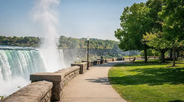
Horseshoe Falls, also called the Canadian Falls, is the one on the postcards — the curved, green-tinted wall of water you see from Table Rock and the Skylon Tower. Its crest measures roughly 670 metres across, and it drops an average of about 57 metres. It also does the heavy lifting: roughly 90 percent of the entire river’s flow goes over this one section. Its shape, curving inward like a horseshoe, concentrates that volume into a smaller crest than you’d expect for that much water, which is a large part of why it reads as more powerful in person than the straighter American Falls next to it.
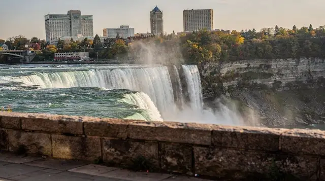
American Falls sits just across the border on the New York side, with a crest of about 260 metres. It’s a straighter drop than the Horseshoe, and shallower in a specific sense: the water falls 21 to 34 metres before it hits a huge pile of fallen rock — a talus slope — at its base, then continues down to the river roughly 57 metres below the crest. That talus pile is itself a visible record of erosion, built up from rockfalls over the centuries, most dramatically after a major collapse in 1954.
Bridal Veil Falls, the smallest of the three, sits immediately beside the American Falls, separated from it by a tiny sliver of land called Luna Island. It carries only a fraction of the flow but produces an outsized amount of mist and noise for its size, largely because the water is funneled into a narrower gap. This is also the section where the American-side walkways at Cave of the Winds bring visitors close enough to get properly soaked.
Together, the three falls form one system with one hydrology, but they are legally, visually, and geologically distinct — and only one of them, the Horseshoe, does most of the actual work.
The numbers behind the view
At peak flow — summer, daytime, high tourist season — more than 168,000 cubic metres of water cross the combined crest lines every minute. That’s the figure worth remembering, because it’s the one that actually describes what you’re looking at on a July afternoon.
But that number isn’t constant, and it isn’t purely natural. It’s the product of a legal agreement.
The 1950 Niagara Diversion Treaty between Canada and the United States sets minimum flow requirements over the falls, and by extension, sets how much of the Niagara River’s water can legally be diverted upstream into hydroelectric intakes on both sides of the border. During tourist season — April 1 through October 31 — a minimum of 2,832 cubic metres per second (100,000 cubic feet per second) must flow over the crest during daylight hours: 8 a.m. to 10 p.m. until mid-September, then 8 a.m. to 8 p.m. after that. Outside those daylight windows, and outside the April-to-October season entirely, the required minimum drops to 1,416 cubic metres per second — half the daytime figure.
Everything above those treaty minimums is fair game for diversion. On a summer afternoon with tourists lining Table Rock, the falls are running close to their full, spectacular volume. At 2 a.m. in February, a much larger share of the river has been quietly redirected into the power stations on both sides of the gorge, and the flow over the crest, while still substantial, is a fraction of what it was twelve hours earlier.
An administered flow, not a natural one
This is worth stating directly rather than glossing over: what you see at Niagara Falls in 2026 is a managed flow, not a wild river doing what it would do on its own. The treaty exists because both countries recognized decades ago that unrestricted hydroelectric diversion could reduce the falls to a trickle during tourist hours, undercutting the very tourism industry the falls support. So a compromise was struck — enough water to look and sound the part during the hours people are watching, and the rest put to work generating electricity for millions of homes on both sides of the border.
None of this makes the falls less real or less worth seeing. The volumes involved, even at the treaty minimum, are still enormous by any ordinary standard — 1,416 cubic metres per second is roughly 1.4 million litres of water every second. But it’s a fact that gets left out of most tourist-facing descriptions, and it changes how you should read claims about the falls being an untouched natural wonder. They’re a managed natural resource, engineered to perform on a schedule, which is a more accurate and, honestly, more interesting story than the postcard version.
The gorge is still moving
The falls have not always been where they are now. When the last ice age retreated roughly 12,500 years ago, meltwater began cutting through the Niagara Escarpment near what is now Queenston and Lewiston, at the northern edge of today’s Niagara Gorge.
Since then, the falls have worn their way upstream roughly 11 kilometres to their current position, carving the gorge as they went. The gorge walls you see from the Niagara Glen on the Canadian side, or from the trails in Whirlpool State Park on the American side, are essentially the old riverbed and the exposed rock layers the retreating falls cut through.
The retreat happens because the crest of each falls is capped by a hard layer of dolostone sitting on top of much softer shale. The falling water undercuts the shale beneath the crest, and periodically a section of the unsupported dolostone cap breaks off and collapses — which is also why sudden rockfalls, like the 1954 collapse at the American Falls, happen from time to time.
Before large hydroelectric diversion began in the early twentieth century, the unrestricted force of the full river pushed the crest back at roughly 1 to 1.5 metres a year. With most of the river’s energy now diverted for power or held back by treaty limits outside of daylight hours, the retreat has slowed to around 30 centimetres a year today — still moving, just far more gradually than it once did. It’s a strange fact to sit with at the railing: the view in front of you is measurably different, in a small but real way, from the view your grandparents had.
The basin, the whirlpool, and the river that feeds it all
Below Horseshoe Falls, the constant pounding of the water has carved a plunge pool roughly 35 metres deep — deeper, notably, than the falls themselves are tall. Downstream, within the gorge, the Niagara River itself reaches depths of around 52 metres in places, a river far deeper and more powerful below the surface than its width alone would suggest.
The Niagara River runs 58 kilometres total, connecting Lake Erie to Lake Ontario with a total elevation drop of about 99 metres — most of that drop concentrated at the falls themselves. It drains a watershed of roughly 684,000 square kilometres, which is effectively the combined outflow of the four upper Great Lakes: Superior, Michigan, Huron, and Erie. That scale is the real explanation for the falls’ power. It isn’t one river’s worth of water crossing the crest; it’s the accumulated outflow of an inland sea system covering a large part of the continent.
Downstream of the gorge, the river makes a sharp turn at the Whirlpool, a natural basin roughly 518 by 365 metres across and about 38 metres deep, formed where the river slams into an ancient, buried river channel and is forced into a tight bend. The rapids feeding into it run for about 1.6 kilometres, dropping 15 metres over that distance, and reach speeds of roughly 9 metres per second — powerful enough that this stretch of river has claimed lives among people who underestimated it. It is not a place to swim or wade, ever, at any water level.
What “frozen falls” actually means
One claim circulates constantly and it needs correcting: Niagara Falls have never fully frozen over in recorded history. The single documented exception was in March 1848, when an ice jam formed on Lake Erie near the mouth of the Niagara River and physically blocked the river’s flow at its source. For roughly 30 hours, the crest ran nearly dry — a genuinely unprecedented event that reportedly drew crowds down onto the exposed riverbed to look at debris and stranded fish. It has not happened since, and there’s no meaningful sign it will.
What does happen, in some winters, is the formation of an ice bridge — a mass of ice floes that accumulate at the base of the falls, pushed there by wind and current, sometimes thick and stable enough that people once walked out onto it before the practice was banned after fatal accidents in the early twentieth century. An ice bridge is a real and photogenic phenomenon, and it can make the falls look partially frozen from a distance.
But underneath and around it, the water keeps moving. The falls have not stopped, and describing them as “frozen” in a given winter is inaccurate even when the ice formations are dramatic. For what’s actually open during a cold-weather visit, see what closes for the season and do the falls freeze.
How the numbers translate to a visit
None of this changes what you should actually do at the falls — it just means you’re doing it with better information. If you want to feel the scale up close rather than just read about it, options on both sides put you at very different distances from the water. A tour combining the boat ride, the Skylon Tower, and a day trip from Toronto that pairs the boat, the tower, and the tunnels behind Horseshoe Falls covers the Canadian-side highlights in one booking, useful if you’re coming up for the day and want the flow numbers above to mean something concrete rather than abstract.
For a shorter window at the falls, a condensed express tour bundling the boat ride, Skylon Tower, and the Journey Behind the Falls fits a half-day rather than a full one. And if you’d rather have someone explain the geology and the treaty history in person while walking the Canadian-side viewpoints, a guided walking tour with a local guide is built for exactly that kind of context.
Whichever way you choose to see it, the core fact is worth carrying with you at the railing: the wall of water in front of you is both an ancient geological process still quietly in motion, carving the gorge at about 30 centimetres a year, and a carefully administered flow governed by a treaty that decides, hour by hour, how much of the Niagara River you’re actually allowed to see. For a sense of how long to give the falls beyond the numbers, see how many days to spend at Niagara Falls and the best time to visit.
Frequently asked questions about the Niagara Falls flow and geology
How much water goes over Niagara Falls each minute?
At peak daytime hours in summer, up to about 168,000 cubic metres a minute cross the combined crest lines. Overnight and outside the April-to-October tourist season, treaty rules allow far more of the river to be diverted to power stations, so the visible flow drops substantially.
Is the flow over Niagara Falls natural?
No. The 1950 Niagara Diversion Treaty between Canada and the United States sets minimum flows over the crest — 2,832 cubic metres per second during tourist-season daylight hours, 1,416 cubic metres per second at night and outside that season — and everything above those minimums can legally be diverted to hydroelectric intakes upstream of the falls.
Which of the three falls carries the most water?
Horseshoe Falls, the Canadian falls, carries roughly 90 percent of the Niagara River’s flow across a crest of about 670 metres. The American Falls and the much smaller Bridal Veil Falls, both on the New York side, share the remaining ten percent.
Do Niagara Falls ever freeze completely?
Not in recorded history, with one exception. In March 1848, an ice jam on Lake Erie blocked the river’s source for roughly 30 hours and the crest ran nearly dry. Some winters build an ice bridge across the base of the gorge, but the falls themselves keep flowing beneath and around it.
How deep is the water below the falls?
The plunge pool at the base of Horseshoe Falls reaches about 35 metres deep — deeper than the falls themselves are tall. The Niagara River downstream of the falls, in the gorge, reaches about 52 metres deep in places.
How fast is the Niagara Gorge eroding today?
About 30 centimetres a year at present, a rate slowed dramatically by hydroelectric diversion. Before large-scale power generation began, the crest retreated at roughly 1 to 1.5 metres a year.
How long is the Niagara Gorge and how old is it?
The gorge is about 11 kilometres long, carved by the falls retreating upstream over roughly 12,500 years since the last ice age exposed the Niagara Escarpment.
Are Niagara Falls the biggest waterfall in the world?
No, and it’s worth being precise about this. Niagara Falls is neither the tallest nor the widest waterfall on Earth. What it does hold is the title of most powerful waterfall in North America by volume, thanks to the sheer size of the Great Lakes basin feeding the Niagara River.
Viewpoints, towers and observation decks on GetYourGuide
Verified deep-linked GetYourGuide tours. Book through these links and we earn a small commission at no cost to you.
GetYourGuide does not provide a product photo for this activity — the image shows the meeting point, photographed by us.