Three falls, one river, very different shares of water
Niagara Falls is not one waterfall. It’s three, split across two countries by a pair of islands, and the American Falls is the one most visitors from the United States meet first, since it sits directly below Niagara Falls State Park in New York. Its crest runs about 260 m — the longest of the three — but it is not the falls doing most of the work. That’s the Horseshoe Falls on the Canadian side, and getting the two straight matters more here than almost anywhere else on this river, because the numbers run against instinct.
The American Falls drops about 21 to 34 m before it hits a slope of broken rock at its base, called the talus, then continues down to the river itself at a total fall of 57 m. That’s a real, loud, photogenic waterfall by any normal standard — it’s just not the dominant one. This page is about what the American Falls actually is, why it looks the way it does, the one time engineers turned it off on purpose, and where to stand to see it properly without repeating what’s already covered on the Prospect Point observation tower and Goat Island pages.
Why the American Falls carries so little of the flow
Every falls on the Niagara River pulls from the same source, the outflow of Lake Erie, but the river doesn’t split its water evenly between the American and Canadian channels. The main current bends toward the Canadian side as it approaches the crest, so roughly 90% of the total flow goes over the Horseshoe Falls, leaving a comparatively small fraction to spread across the American Falls’ 260 m of crest.
That imbalance is also managed by treaty, not left entirely to nature. Under the 1950 Niagara Treaty, a minimum combined flow of 2,832 cubic metres per second is required to pass over both falls together during daytime hours from April through October, dropping to 1,416 cubic metres per second overnight and in winter. Whatever the river carries beyond those minimums is diverted to hydroelectric intakes upstream. The water tourists see at any given hour, on either side, is an administered flow, not a raw one — worth knowing before assuming what’s visible is the full river.
Because so much less water reaches the American channel to begin with, the American Falls has always looked and sounded gentler than the Horseshoe. It’s not a smaller waterfall in every sense — its crest is actually longer — but it is a lower-volume one, and that’s the single fact this page exists to get right. Anyone claiming the American Falls carries the majority of Niagara’s water has it backwards.
The talus slope: why the drop looks shorter than it is
The 57 m figure is the American Falls’ true height from crest to river. But almost nobody experiences it that way, because a broken pile of rock — the talus — has built up at the base over centuries of rockfall, burying the lower part of the plunge. What visitors actually see falling through open air is closer to 21 to 34 m before water hits that slope and continues down to the river underneath it.
This is a real structural difference from the Horseshoe Falls, which drops into a genuine plunge pool roughly 35 m deep rather than a rock pile. The Horseshoe’s greater volume has kept its base scoured out; the American Falls’ comparatively lighter flow hasn’t had the same effect, and rock that breaks off the cliff face has nowhere to go but accumulate. It’s a visible, permanent record of erosion, and the reason engineers eventually wanted a closer look at what was happening underneath it.
1969: the summer the American Falls ran dry
In June 1969, the US Army Corps of Engineers built a temporary rock and earth dam across the head of the American channel, at the upstream end near the Three Sisters Islands, and redirected the entire flow of that channel over to the Horseshoe side. For about five months, the American Falls had no water passing over its crest at all — just the bare rock face and the talus slope, dry and exposed for the first time in living memory.
The point wasn’t spectacle. Engineers wanted to inspect the rock face directly, assess how much material was likely to break off in future rockfalls, and study whether removing some of the accumulated talus would restore a taller visible drop. In the end, the Corps left the talus in place — clearing it was judged too costly and too risky for the structure of the falls — but the inspection work went ahead, and cleanup crews removed two bodies discovered in the exposed riverbed during the dewatering.
The photographs from that summer are genuine and still circulate widely: a wide, dry rock shelf where a waterfall should be, onlookers walking on ground that’s normally submerged. The dam came down that November and the American Falls has flowed continuously since. It remains the only time in the modern era that one of Niagara’s three falls has been deliberately switched off, as distinct from the natural 1848 ice jam that briefly stopped the whole river.
Where to see the American Falls today
Two spots do the job well, and this page won’t repeat their full detail since each has its own page. Prospect Point, at the edge of the state park, is the closest approach on foot and the base of the observation tower that leans out over the gorge.
Luna Island, the narrow strip of land connected to Goat Island, sits right at the boundary between the American Falls and the smaller Bridal Veil Falls next to it, close enough that spray reaches visitors on breezy days. Between the two, a full guide to viewpoints on the American side and a companion piece on Table Rock, Terrapin Point and Luna Island cover angles, timing and crowd patterns in more depth than belongs here.
Both viewpoints are free to reach — entry to Niagara Falls State Park itself costs nothing, which is one of the real advantages of the American side over the Canadian one, where the closest comparable free viewpoint is Table Rock at the Horseshoe.
American Falls versus Bridal Veil Falls: don’t mix them up
The American Falls and the Bridal Veil Falls sit right next to each other, separated only by the narrow strip of Luna Island, and it’s an easy mix-up to make in photos and in conversation. They are not the same waterfall. The Bridal Veil Falls is the smallest of Niagara’s three sections, with its own crest and its own comparatively modest share of the flow, and it’s the one directly behind the Cave of the Winds walkway rather than the American Falls proper. Guides and brochures sometimes group the two together loosely as “the American side falls,” which is fair shorthand for the pair, but treating them as one and the same waterfall gets the geography wrong.
Getting close to the water
The best way to feel the scale of either American-side waterfall is from the water or the walkways beneath it, not just from the rim. The Maid of the Mist boat departure on the American side runs from docks below Prospect Point and takes in both the American Falls and the Horseshoe from the river itself, which is the clearest way to register the difference in volume between them side by side.
For a route that adds the walkways at the base of Cave of the Winds to a boat ride, the Niagara Falls USA cave and boat combination pairs the two experiences in one outing.
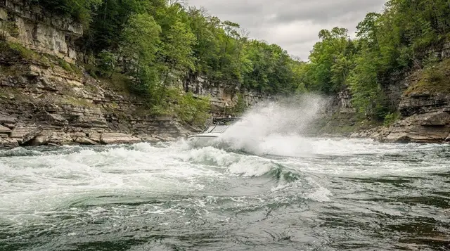
Travellers who’d rather stay on the water without the walking portion can book the 45-minute jet boat run on the Niagara River, which covers the lower Niagara Gorge below both falls rather than approaching the crest itself — a different kind of view, more about the river’s power downstream than the waterfalls up close.
Practical facts for a visit
| Detail | American Falls |
|---|---|
| Crest length | About 260 m |
| Visible drop to talus | 21–34 m |
| Total drop to river | 57 m |
| Share of Niagara’s flow | Small fraction; Horseshoe carries ~90% |
| Closest viewpoints | Prospect Point, Luna Island |
| Entry cost | Free (Niagara Falls State Park) |
| Nearest boat tour dock | Below Prospect Point, American side |
| From | Distance to American Falls |
| Buffalo, NY | About 34 km (21 mi) |
| Toronto, ON | About 130 km (81 mi), across the border |
| Niagara Falls, Ontario | About 2 km, across the Rainbow Bridge |
If a single day is the plan, one day at Niagara Falls works through both sides in sequence, with the American Falls fitting naturally into a morning spent around Prospect Point and Goat Island before crossing to the Canadian side for the wider view of the Horseshoe.
For the fuller picture of how Niagara’s flow is managed rather than purely natural, the flow is a treaty, not nature goes into the numbers behind the daytime and overnight minimums referenced above, and Niagara Falls explained is the starting point for how all three falls relate to each other. Anyone wondering whether the ice formations here in January mean the falls have frozen over should read do the falls freeze before repeating that claim — they haven’t, not since a single ice jam in 1848 stopped the whole river rather than one section of it.
Common questions about the American Falls
Is the American Falls the biggest of Niagara’s three waterfalls?
No. It has the longest crest of the three, about 260 m, but it carries only a small share of the river’s total flow. The Horseshoe Falls on the Canadian side takes roughly 90% of the water and is the one people mean when they picture Niagara’s power.
Why does the American Falls look smaller if its crest is longer?
Crest length and water volume are different things. The American Falls stretches wider than the Horseshoe, but the Niagara River’s main channel bends toward the Canadian side, so most of the flow follows the Horseshoe’s curve. What reaches the American side is a comparatively thin sheet spread across a long edge.
What happened to the American Falls in 1969?
The US Army Corps of Engineers built a temporary dam across the head of the American channel and diverted its flow to the Horseshoe side for about five months, leaving the American Falls dry. The goal was to study rockfall and erosion risk on the talus slope, not to alter the falls permanently. The channel was reopened that November.
Where is the best place to see the American Falls up close?
Prospect Point, at the edge of Niagara Falls State Park, and Luna Island, the small strip of land between the American and Bridal Veil sections, are the two closest viewpoints. Both sit right at river level rather than looking down from a height.
Are the American Falls and the Bridal Veil Falls the same waterfall?
No, they’re separate. The Bridal Veil Falls is the smallest of the three, divided from the American Falls by the narrow strip of Luna Island. They’re often photographed together because they sit side by side, but they have distinct crests and distinct amounts of water passing over them.
Can you get right up to the base of the American Falls?
Not directly beneath the main drop the way Cave of the Winds puts you near the Bridal Veil Falls. The closest approach to the American Falls itself is along the riverside paths and observation points on Goat Island and at Prospect Point, at the top and along the gorge rim rather than at the plunge pool.
Does the American Falls freeze in winter?
It never stops flowing entirely — Niagara has only gone dry once, in an 1848 ice jam upstream, and that affected the whole river, not one section. In cold winters, spray from the American Falls builds up thick ice formations along the rocks and talus, which can look frozen solid from a distance even though water keeps moving underneath.
Why is there a pile of rock at the base of the American Falls?
That’s the talus slope, built up over centuries from rockfall off the crest and cliff face. It’s the reason the American Falls’ visible drop, 21 to 34 m, is shorter than its full 57 m fall to the river — a large part of the plunge lands on accumulated rock rather than in open water, unlike the Horseshoe, which drops into a deep plunge pool.